Earth Science Week Classroom Activities
Exploring Energy with GIS

Activity Source:
ESRI. Adapted with permission.
Locating crucial energy resources involves examining phenomena under, on, and above Earth’s surface. Some of these phenomena change frequently, such as winds. Others, such as oil and coal deposits, are products of long series of geologic processes. Yet all are geographic in nature — they occur in specific places for specific reasons. To determine the best regions to explore for new natural gas deposits, to determine the ideal places for wind farms, or to locate the best rooftops for solar panels in a city, Geographic Information System (GIS) technology and methods are vital.
GIS is equally valuable in moving from exploration or resource siting to production and distribution. For instance, geographic thinking and decision making are critical in determining where to locate the pipeline moving natural gas from its source to the power plant, as well as the nature and capacity of the grid that moves electricity produced there. Likewise, GIS finds extensive use in other energy-related applications, whether in helping mitigate an environmental disaster such as an oil spill or informing a diplomatic endeavor in a world of “haves” and “have nots.”
Geoscientists, energy researchers, and others in numerous careers and disciplines use GIS and its integrative nature to tackle these issues. You can, too.
Materials
- Computer with an Internet connection
Procedure
Go to the Esri Education Community for a series of lessons, including those depicted by these maps. The site also includes pathways to free GIS software, online mapping sites, and other resources.
Help your students discover how Earth science and GIS “energize” life on Earth.
ESRI
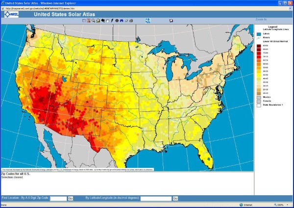
The sun shines everywhere, but are all places equal in potential for use as solar energy farms? This map viewer from the National Renewable Energy Laboratory (NREL) uses Web GIS to explore this question.
ESRI
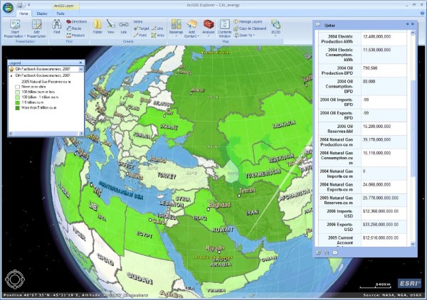
Natural gas may power more of the future in the United States as new domestic discoveries are made, but where else is this resource present — or absent? CIA Factbook data and ArcGIS Explorer provide a good way to examine these and other questions.
ESRI
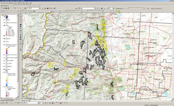
What combination of factors makes one location better than another for a wind farm? ArcGIS Desktop and NREL data provide an excellent way to visualize and analyze sites suitable for a wind farm in Colorado (black), including those with the highest wind speeds (yellow).
ESRI
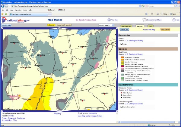
Coal is an abundant fossil fuel, and all forms of it will burn, but not all coal is the same. Anthracite and some bituminous coal are sought after, as they contain low quantities of elements like sulfur and nitrogen. The National Atlas map viewer aids in discovering where they can be found.