Earth Science Everywhere
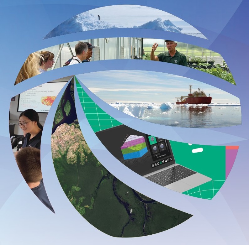
“Earth Science Everywhere,” the theme of Earth Science Week 2024 (October 13-19), explores the many ways that earth science is conducted — by various types of people and professions in interconnected disciplines — to help solve problems for communities and the planet.
You are invited to join in the celebration of Earth Science Week 2024. Play your part by learning about and raising awareness of how earth science being done in your community is helping solve problems and improving sustainability.
Table of Contents:
- Earth Science Week Poster
- Earth Science Week Poster Learning Activties
- 2024 Geologic Map Day Poster: Geologic Map of the Moon
- 2024 Geologic Map Day Poster: Mapping Craters on the Earth and the Moon
- 2024-2025 ESW Calendar Activities
- Other Earth Science Everywhere Resources
- Get Involved in Earth Science Week
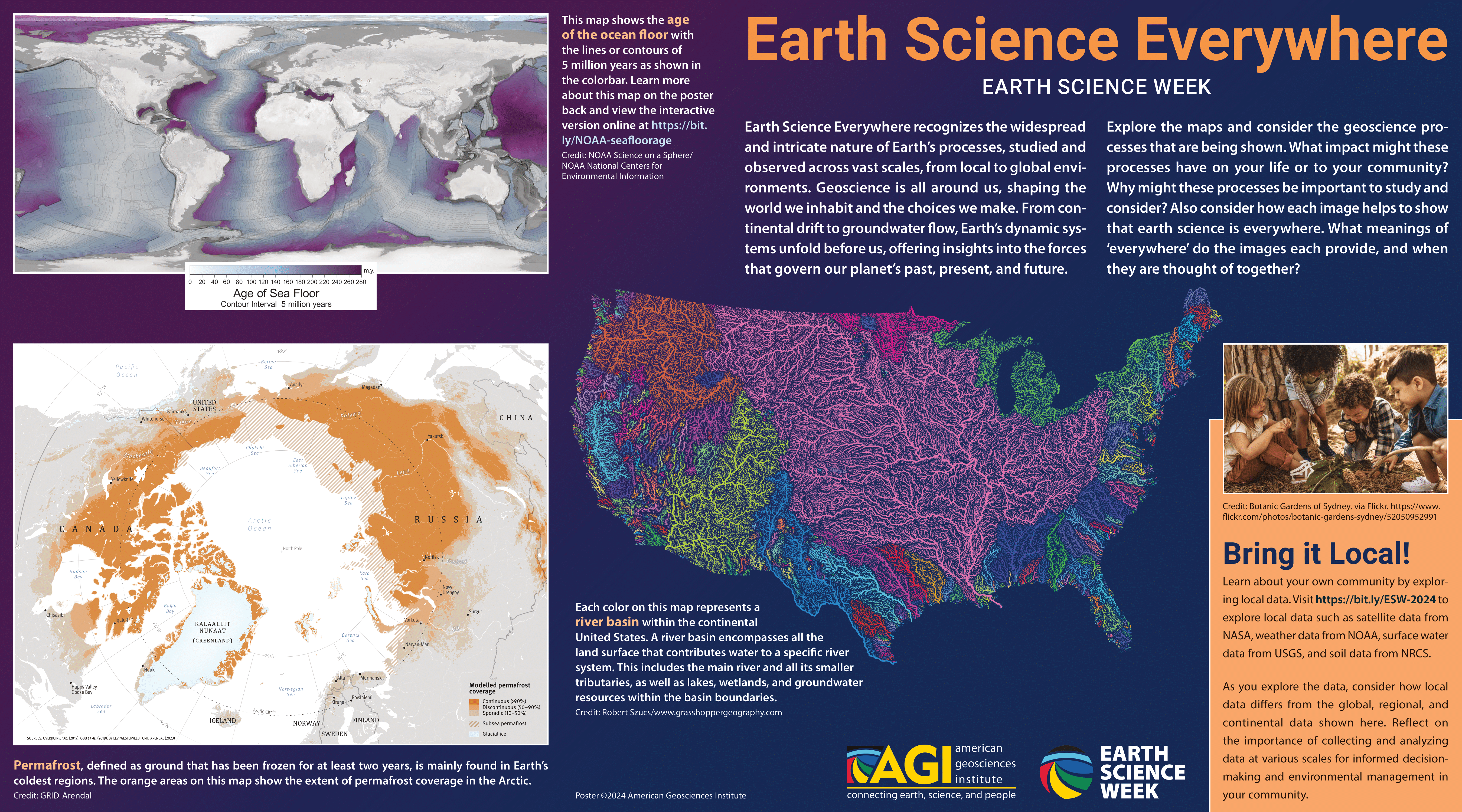
2024 Earth Science Week Poster
Bring It Local!
Use the following data platforms to examine local data:
- Web Soil Survey provides soil data and information produced by the National Cooperative Soil Survey and operated by the U.S. Department of Agriculture Natural Resources Conservation Service ( USDA NRCS).
- The U.S. National Water Dashboard provides real-time water data collected at the U.S. Geological Survey (USGS) observation stations.
- Earth System Data Explorer is a My NASA Data visualization tool that helps learners visualize complex Earth system data sets over space and time.
- Earthdata from NASA offers a variety of satelitte and remote sensing data related to Earth’s atmosphere, land , and oceans.
- Climate Data Online provides access to NCDC’s archive of global historical weather and climate data, and is opperated by the National Oceanic and Atmospheric Administration (NOAA).
- Open Topography provides high-resolution topography data from lidar and other sources, with tools for accessing and analyzing these data.
As you explore the data, consider how local data differs from the global, egional, and continental data. Reflect on the importance of collecting and analyzing data at various scales for informed decisionmaking and environmental management in your community.
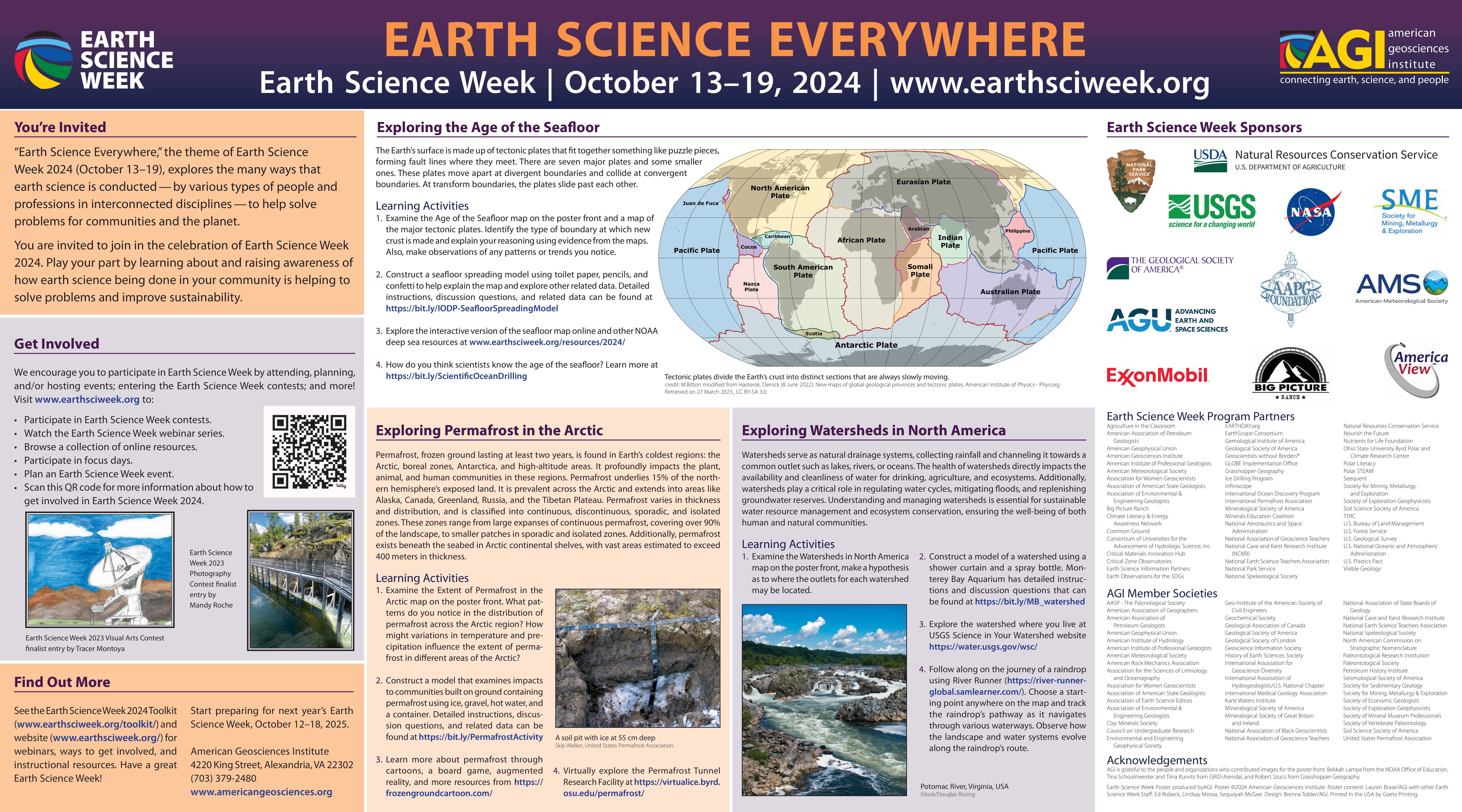
Earth Science Week Poster Learning Activities
Three learning activities are on on the back of the poster that utilize the maps on the poster front:
- Exploring the Age of the Seafloor
- Exploring Permafrost in the Arctic
- Exploring Watersheds in North America
Dive into NOAA’s interactive of the Seafloor spreading map featured on the poster front, along with other deep-sea activities, interactives, and media:
- Exploring with Multibeam Sonar
- Mapping the Ocean Floor: Bathymetry
- Ocean Exploration Education Materials by Theme
- Exploring the Deep Ocean with NOAA
- Deep Ocean Education Project
- Deep Sea Dive Video Collection
- What Is Hydrography? Infographic
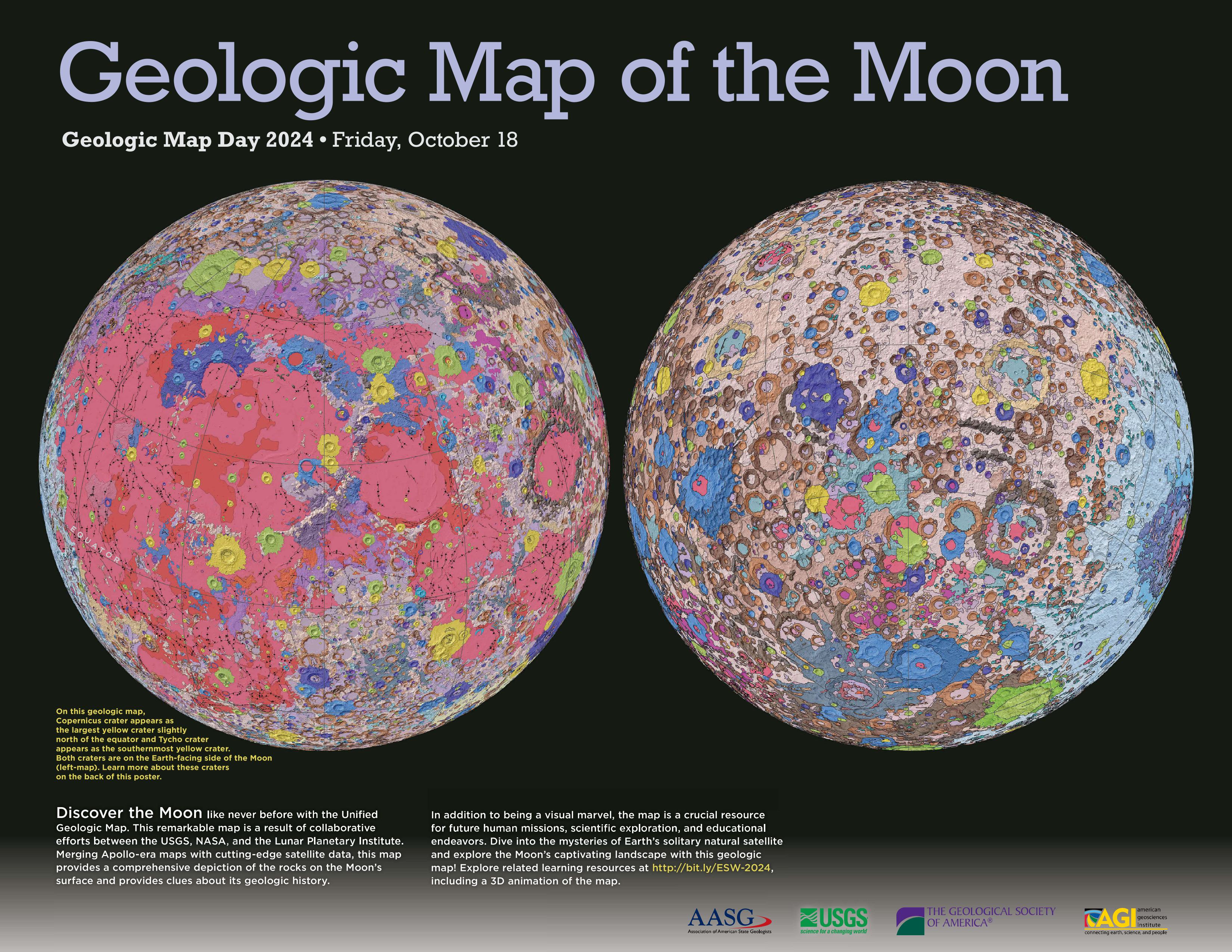
2024 Geologic Map Day Poster: Geologic Map of the Moon
Explore the Unified Geologic Map of the Moon in greater detail, including the full key, from the USGS Astrogeology Science Center.
Learning Activities
- Look closely at the geologic map of the Moon on the poster.
- Which craters do you think are older, and which do you believe are younger? Back up your ideas using evidence from the map. Next, learn the real ages of the craters by researching and checking your hypotheses.
- How does the geologic map of the near side of the Moon (on the left) compare to the geologic map of the far side of the Moon (on the right)? What are some geologic processes that might explain these similarities and differences?
- Explore different geologic features on the Moon using NASA’s Moon Trek.
- Identify and compare craters on the moon and consider how impacts may have affected the lunar surface differently based on crater size and location.
- Select two craters and analyze their cross sections. How do the cross sections compare and what processes may have affected their formation?
- Locate the Maria (dark colored) and Highlands (lighter colored), and consider why they appear different in color and texture.
- Trace the Apollo missions, and identify the locations on the Geologic Map of the Moon. Consider why these locations where chosen.
- Analyze elevation data to identify the lowest and highest point on the Moon. What geological events could have led to these features?
- Study the composition of the lunar surface using the spectral data available around a specific crater. Locate that crater on the geologic map of the moon, and consider how the variations in material compare to the geologic map.
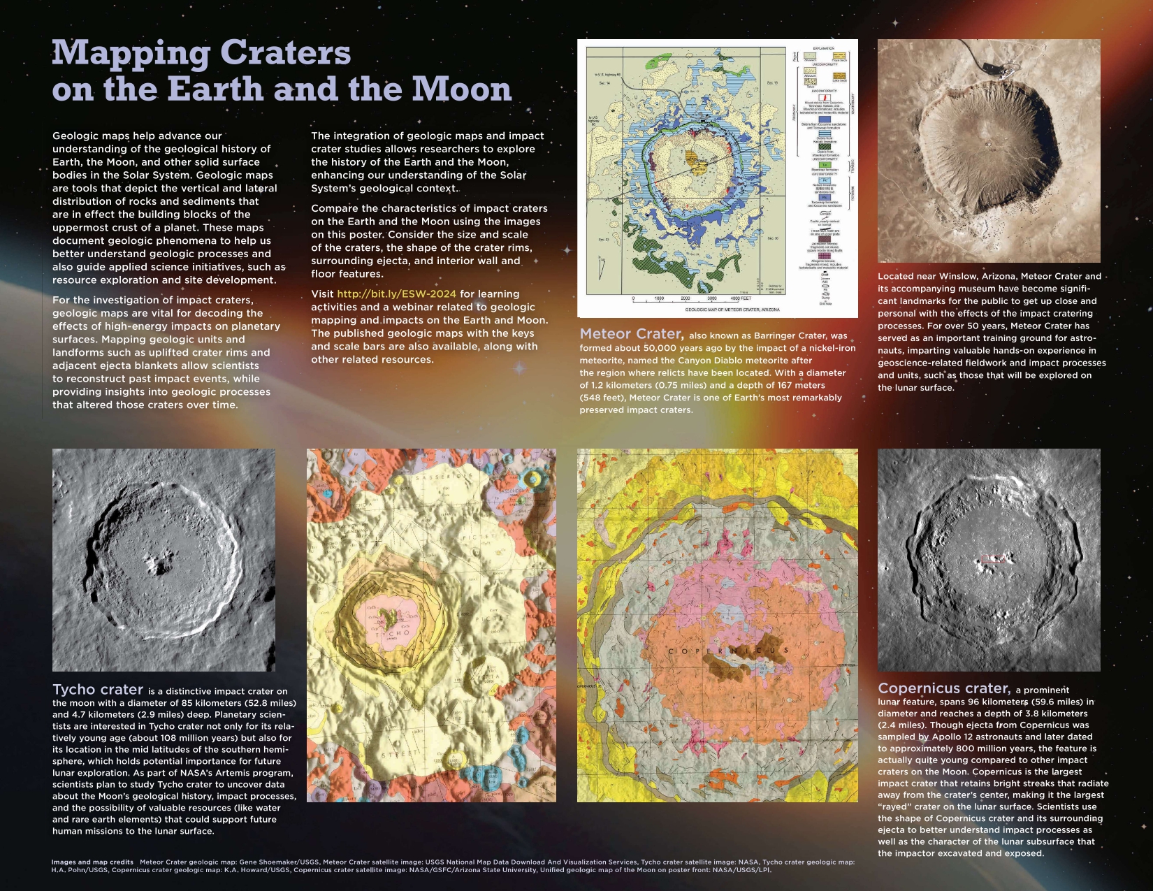
2024 GMD Poster: Mapping Craters on the Earth and the Moon
Learning Activities
-
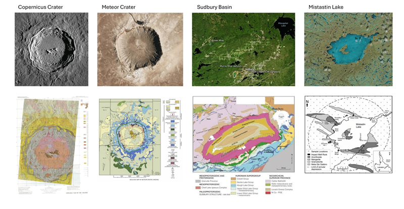
Investigate the satellite images and maps provided on the Impact Crater side of the poster. Consider the varying scales of the craters depicted in these images. Reflect on the factors influencing differences in crater sizes and propose hypotheses about the geological processes involved. How might variations in scale impact our understanding of impact crater formation and planetary geology?
-
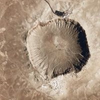
Analyze and compare the geologic features of two prominent impact craters: Copernicus Crater on the Moon and Meteor Crater on Earth. What similarities and what differences do you observe in the satellite images and on the maps? How might these craters have been formed and what geological processes may have shaped their landscapes?
-
Compare satellite images and geologic maps of Copernicus Crater, Meteor Crater, Sudbury Basin, and Mistastin Lake. All contain features that were formed from meteor impacts on Earth. Make a comparison chart, identifying similarities and differences between the craters. What geological processes may have shaped their landscapes?
-
Explore the USGS Astrogeology Science Center’s Interactive Map (Meteor Crater to be added soon) to see rock samples that have been collected from within and around the crater. Reconstruct sediment columns through observations of the sediment samples at each site and make comparisons between different sites.
-
Get a sense of the scale of Meteor Crater by visiting the Zoom to Meteor Crater from Space page from NASA’s Scientific Visualization Studio to see Meteor Crater from space.
-
Model impact cratering processes and debris, and explore NASA Moon Treks through this ESW Investigating Impacts 5E lesson. For the teacher’s edition with setup instructions and suggested responses, email us at outreach@americangeosciences.org
-
Learn more about other impacts and craters on Earth at Earth Impact Database and Terrestrial Impact Cratering and Its Environmental Effects.
2024-2025 ESW Calendar Activities
- Monitoring Sustainability: Land Cover Data
- Exploring Low-Temperature Geothermal Energy
- Lasting Impressions: Making Molds
- Exploring Meteor Impacts on Earth and Beyond
- My Mineral
- What Does Data Sound Like?
- Beat the Uncertainty: Planning Climate-Resilient Cities
- Cores for Kids
- Soil Glue
- Using Global Earth Science Data
- EarthCaches are Everywhere!
- Mining Makes Life Possible
Other Earth Science Everywhere Resources
Get Involved in Earth Science Week
How can you get involved? Explore the links below and others on the Earth Science Week website to find a host of tools designed to make planning and attending events easy, fun, and rewarding! We have many resources to help you work with local geoscience professionals to engage young people and others in events that help everyone to consider their role in Earth science, innovation, and sustainability.
- Plan an Earth Science Week event
- Participate in Earth Science Week contests
- Watch the Earth Science Week webinar series
- Participate in focus days
- Learn more about how others have promoted events in the 2023 Earth Science Week Highlights Report
Do you have resources you would like to share with the K-12 community related to the 2024 Earth Science Week theme Earth Science Everywhere? Please eamil us with “ESW 2024 Website Addition” as the subject line outreach@americangeosciences.org

