Earth Science Week Classroom Activities
Exploring Climate Change with GIS
Activity Source:
ESRI. Adapted with permission.
Earth’s climate is a product of and is affected by many things—and it’s changing. Long-term and short-term processes, such as plate tectonics and volcanism, contribute to climate. Likewise, human influences, such as rising CO2 levels from fossil fuel burning and deforestation, play active roles.
The expression of climate change is seen in a variety of forms: Erratic weather patterns and rising sea levels are among the most discussed. There are also interdependent ripple effects that can include the spread of disease, famine, conflict, loss of habitat and biodiversity, and other less immediately visible social, political, and environmental events.
The factors at play in shaping our climate as well as the manifestation of its effects are geographic in nature. Geographic Information System (GIS) technology and methods are vital in documenting, monitoring, analyzing, and predicting these dynamic activities and interdependencies. Climate scientists and others in numerous careers and disciplines use GIS and its integrative nature to tackle these issues. You can, too.
Materials
- Computer with Internet connection
Procedure
Go to https://community.esri.com/t5/education/ct-p/education for a series of lessons, including those depicted by these maps.. The site also includes pathways to free GIS software, online mapping sites, and other resources. Discover how earth science and GIS make a difference to life on our planet.

ESRI
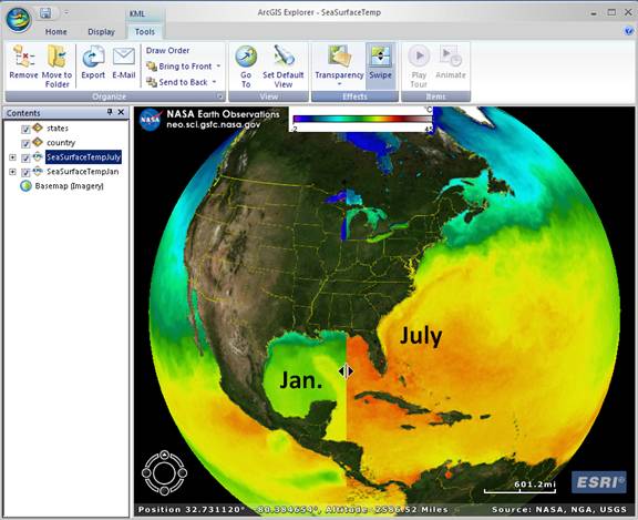
Sea surface temperatures vary by season and year. Using NASA data, ArcGIS Explorer allows you to compare these temporal differences as well as other indicators.

ESRI
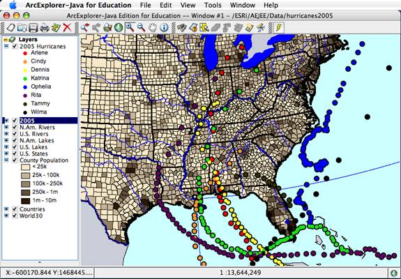
Hurricane activity and strength are related to warm seas. Here, ArcExplorer Java Edition for Education (AEJEE) is used to map the powerful 2005 season using NOAA data.

ESRI
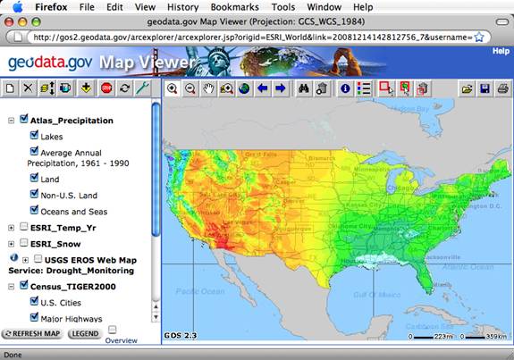
Near-term average weather patterns can help create a picture of what might come. The Geodata.gov web site has these as well as dynamic weather and climate resources.

ESRI
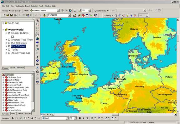
Long-term climate change can have devastating global consequences. A lesson in the book Mapping Our World explores future scenarios of sea level change—here a 5 meter rise—using ArcGIS.

