Geologic Map Day
Welcome to Geologic Map Day, a special event designed to promote awareness of geologic mapping and its vital importance to society.
As an extension of the National Cooperative Geologic Mapping Program, Geologic Map Day focuses the attention of students, teachers, and the general public on the creation, study, uses, and significance of geologic maps for education, science, business, and a variety of public policy concerns.
Organizing partners of Geologic Map Day are the United States Geological Survey, the American Association of State Geologists, the Geological Society of America, and the American Geosciences Institute. The event is celebrated on the Friday of AGI’s Earth Science Week, a public awareness campaign that reaches over 50 million people each year with educational resources, information, and activities promoting awareness of Earth science. Please join us!
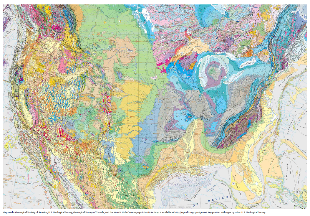
2025 Geologic Map Day Poster
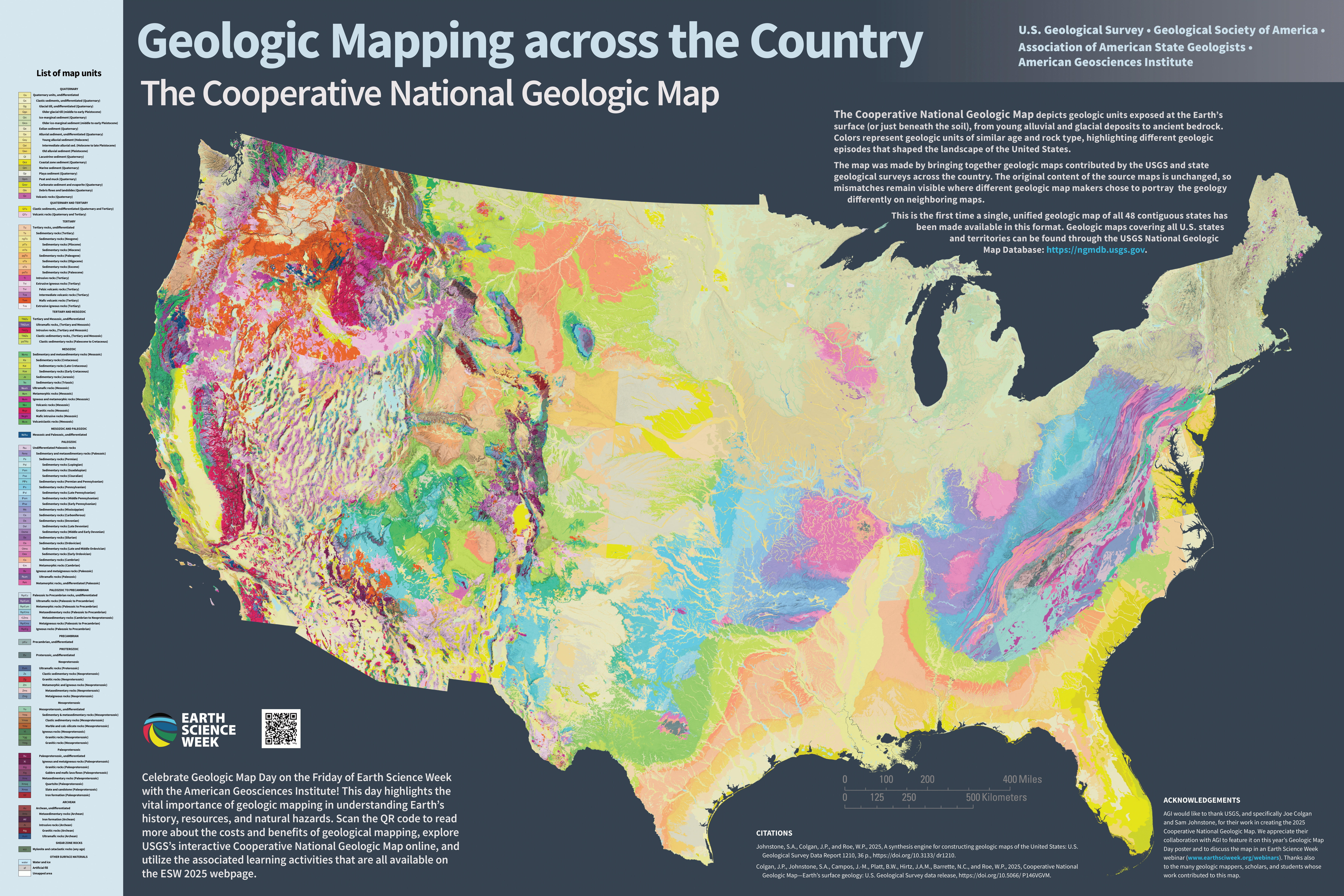
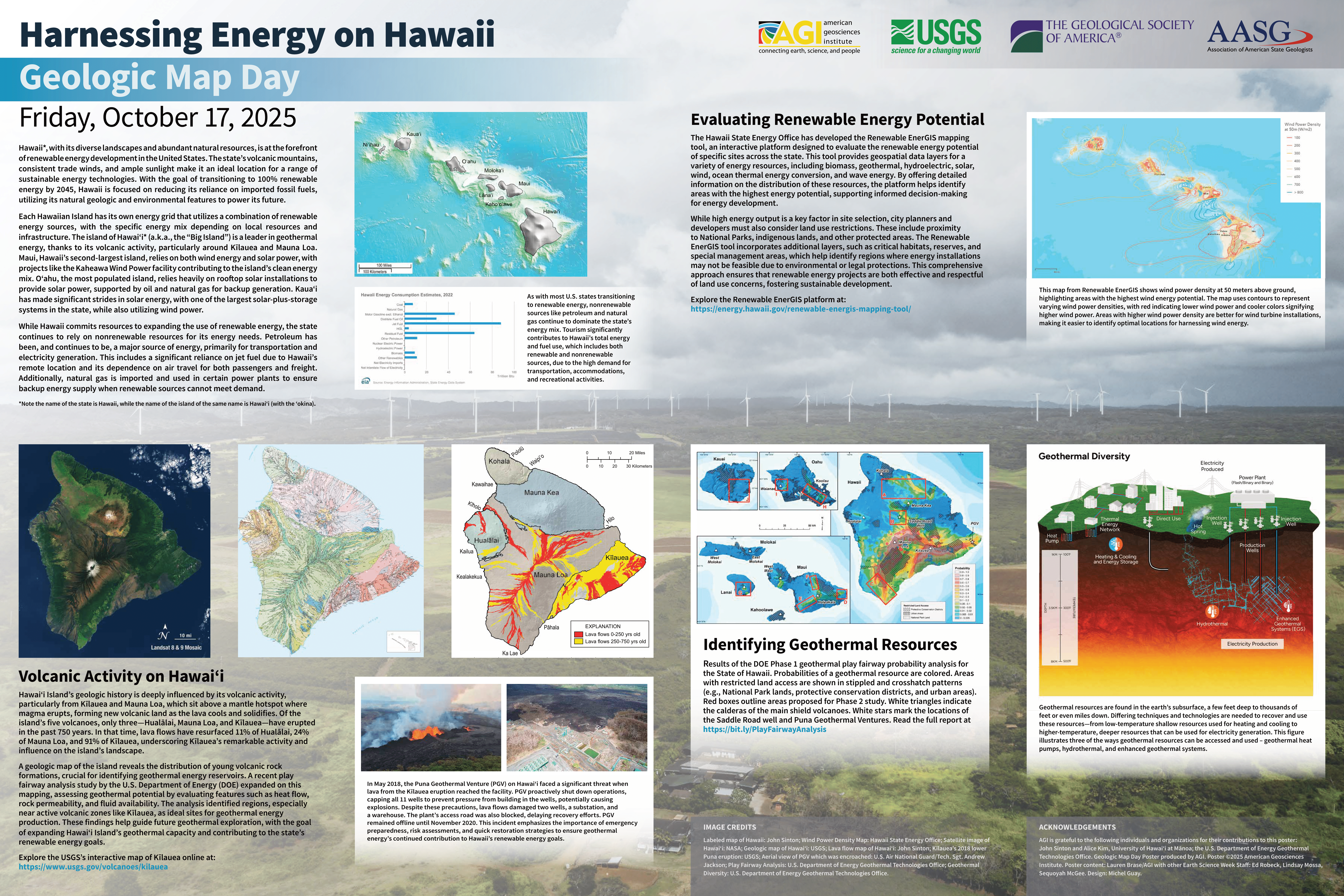
Visit the 2025 ESW page for learning activities that use the 2025 GMD poster. Watch a webinar about the Cooperative National Geologic Map that was featured on one side of the GMD poster in an ESW Webinar, Geologic Mapping and Modeling.
2024 Geologic Map Day Poster
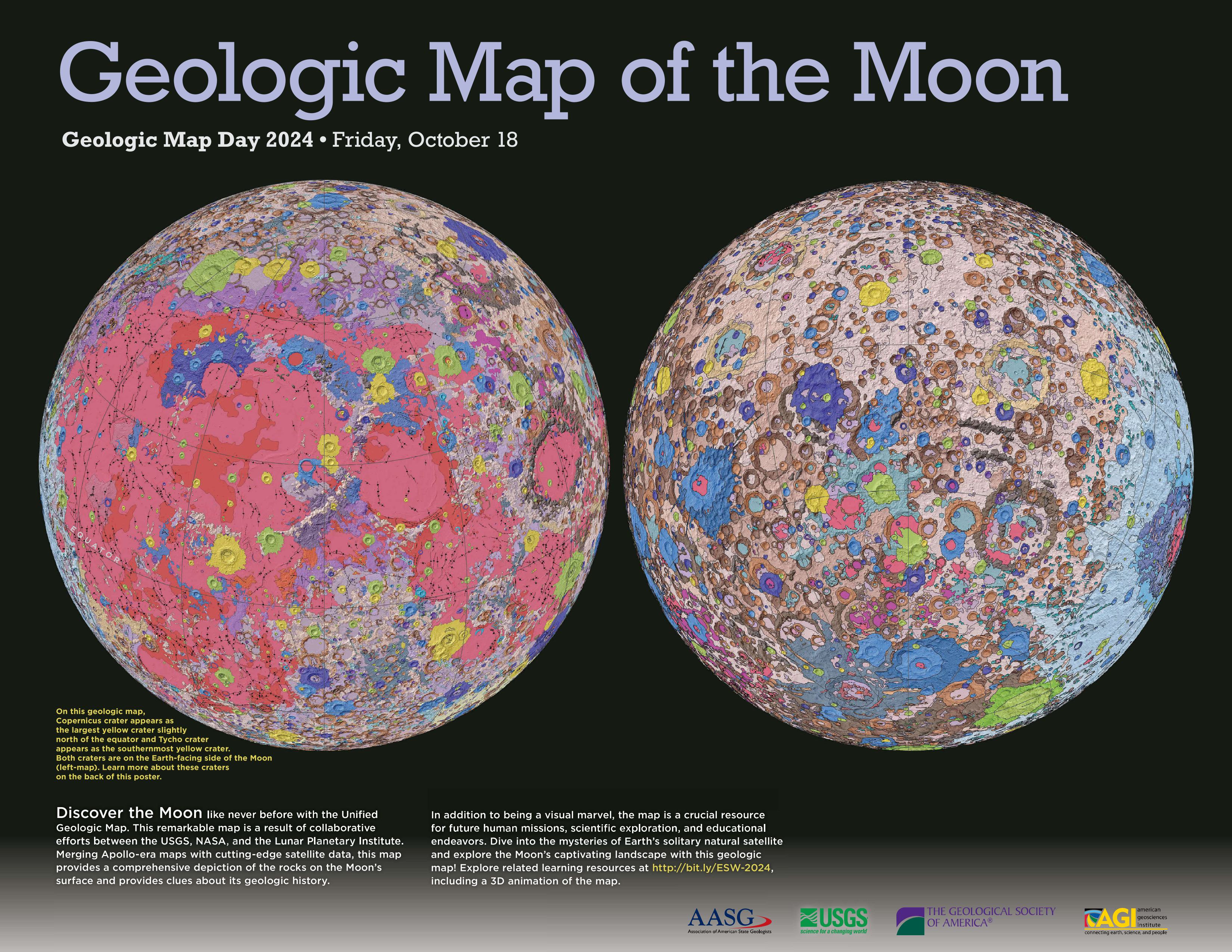
Visit the 2024 ESW page for learning activities that use the 2024 GMD poster, which features the geologic map of the moon on the front, and images and maps of Meteor Crater, Tycho crater, and Copernicus crater on the back.
Activity: Investigating Impacts
Other Geologic Map Day Learning Activities
Activity: Lidar Improves Geologic Maps
Activity: Applications of Lidar
Activity: Soil’s Role in Carbon Sequestration
Activity: Observing Soil Respiration
Activity: Different Times, Different Environments
Activity: Looking Below Earth’s Surface
Activity: Processes Below The Water
Activity: Clear as Black and White
Activity: Getting Creative - Create Your Own Map
Activity: Karst, Sinkholes, and Human Activity
Activity: What’s Under My Feet? Learning to Use a Geologic Map
Activity: Geologic Maps & Earthquakes
Activity: Visualizing Terrain with Maps
Activity: Geologic Maps and Groundwater
Activity: Why Settle at Mesa Verde?
Geologic Map Day Resources
Geologic Maps and Natural Hazards
Geologic Mapping and Public Health Factsheet
Geologic Mapping for the Nation Factsheet
Economic Analysis of the Costs and Benefits of Geological Mapping